| Comté de Clay (Clay County) | |
 Ancien palais de justice fédéral et bureau de poste à Moorhead | |
| Administration | |
|---|---|
| Pays | |
| État | |
| Chef-lieu | Moorhead |
| Fondation | 8 mars 1862 |
| Démographie | |
| Population | 65 318 hab. (2020) |
| Densité | 24 hab./km2 |
| Géographie | |
| Coordonnées | 46° 54′ nord, 96° 29′ ouest |
| Superficie | 270 700 ha = 2 707 km2 |
| Superficie eau | 2 000 ha = 20 km2 |
| Superficie totale | 272 700 ha = 2 727 km2 |
| Localisation | |
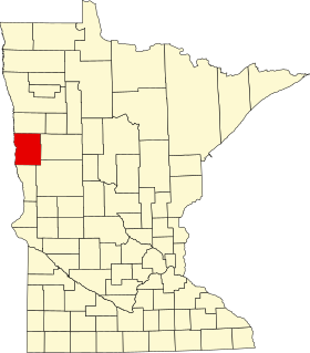
 Comté de Clay | |
| modifier |
|
Le comté de Clay est situé dans l’État du Minnesota, aux États-Unis. Il comptait 65 318 habitants en 2020. Son siège est Moorhead.
Lieux notables
- District historique de Buffalo River State Park WPA/Rustic Style Historic Resources
Liens externes
- (en) Site officiel


