


Taille de cet aperçu : 800 × 577 pixels. Autres résolutions : 320 × 231 pixels | 640 × 462 pixels | 1 024 × 739 pixels | 1 280 × 923 pixels | 2 560 × 1 847 pixels | 4 807 × 3 468 pixels.
Fichier d’origine (4 807 × 3 468 pixels, taille du fichier : 14,26 Mio, type MIME : image/png)
Ce fichier et sa description proviennent de Wikimedia Commons.
Description
| Description |
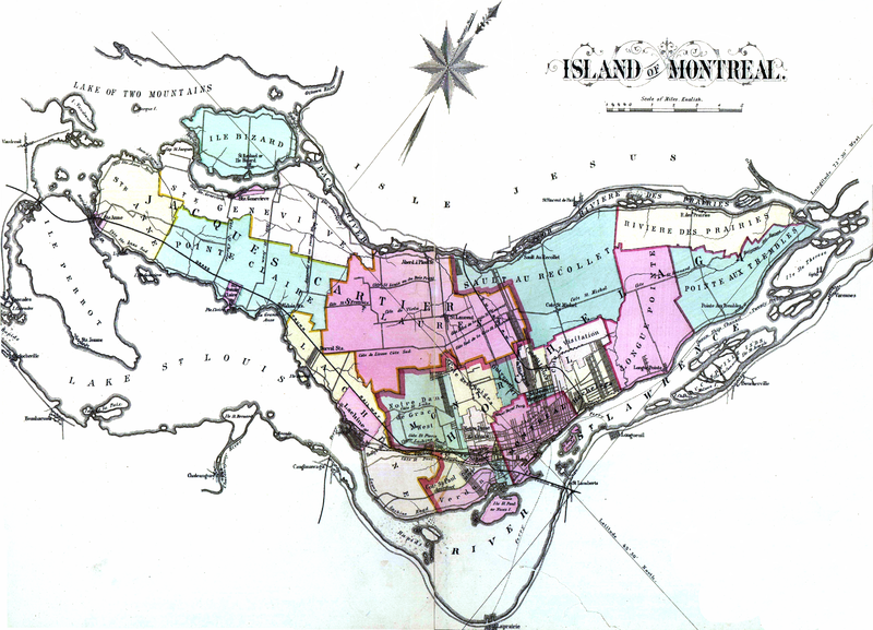
English: Atlas of the city and island of Montreal, including the counties of Jacques Cartier and Hochelaga ; from actual surveys, based upon the cadastral plans deposited in the office of the Department of Crown Lands
Français : 1 atlas (107 p.) : cartes en coul. ; 45 cm. Colorié à la main |
||||||||||||||||||||||
| Date | |||||||||||||||||||||||
| Source |
|
||||||||||||||||||||||
| Auteur |
|
||||||||||||||||||||||

Conditions d’utilisation
|
Cette œuvre est également dans le domaine public dans tous les pays pour lesquels le droit d’auteur a une durée de vie de 100 ans ou moins après la mort de l’auteur. | |
| Ce fichier a été identifié comme étant exempt de restrictions connues liées au droit d’auteur, y compris tous les droits connexes et voisins. | |
Historique du fichier
Cliquer sur une date et heure pour voir le fichier tel qu'il était à ce moment-là.
| Date et heure | Vignette | Dimensions | Utilisateur | Commentaire | |
|---|---|---|---|---|---|
| actuel | 26 avril 2013 à 03:19 | | 4 807 × 3 468 (14,26 Mio) | Jeangagnon | {{Information |Description ={{en|1=Atlas of the city and island of Montreal, including the counties of Jacques Cartier and Hochelaga ; from actual surveys, based upon the cadastral plans deposited in the office of the Department of Crown Lands }} {{... |
Utilisation du fichier
Les 2 pages suivantes utilisent ce fichier :
Usage global du fichier
Les autres wikis suivants utilisent ce fichier :
- Utilisation sur www.wikidata.org