


Fichier d’origine (3 158 × 3 388 pixels, taille du fichier : 961 kio, type MIME : image/jpeg)
Ce fichier et sa description proviennent de Wikimedia Commons.
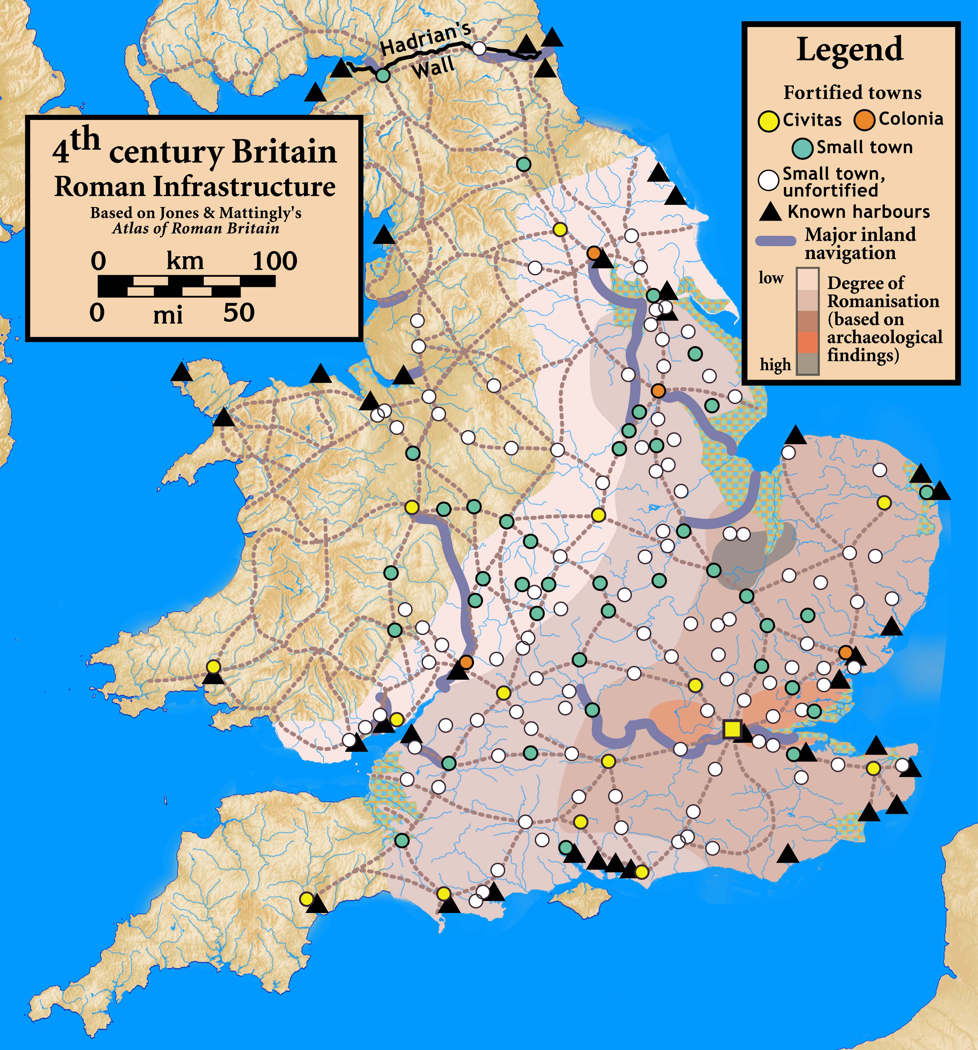
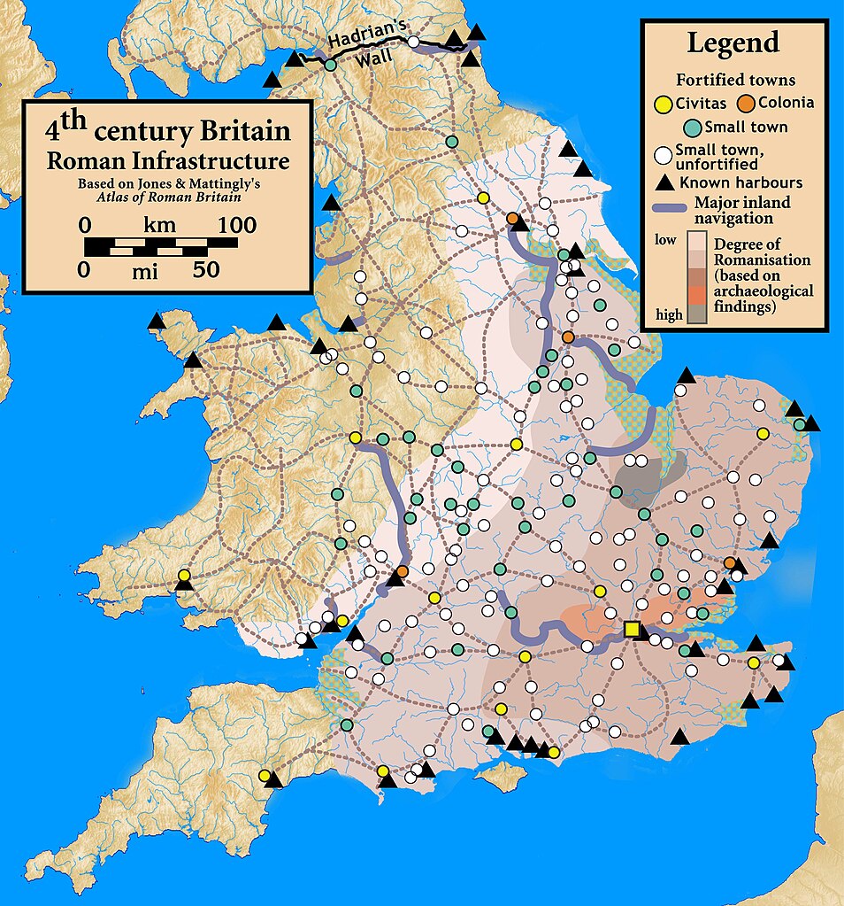
| Description | Roman Infrastructure in 4th century Britain |
| Date | |
| Source |
Based on Jones & Mattingly's Atlas of Roman Britain (ISBN 978-1-84217-06700, 1990, reprinted 2007) — the source is cited in the image legend — locations of towns (fortified and unfortified) are given on p. 156, with tribal civitates and coloniae specified on p. 154; major inland waterways are from p. 199; the degree of Romanisation ("boundaries of acculturation" with levels from "high density" to "low density" in the text) are given on page 151, with the authors citing it as a computer-generated map based on data contained in the standard Ordnance Survey map of Roman Britain; roads are from several sources, including the Antonine Itinerary.
|
| Auteur | my work |
- Vous êtes libre :
- de partager – de copier, distribuer et transmettre cette œuvre
- d’adapter – de modifier cette œuvre
- Sous les conditions suivantes :
- paternité – Vous devez donner les informations appropriées concernant l'auteur, fournir un lien vers la licence et indiquer si des modifications ont été faites. Vous pouvez faire cela par tout moyen raisonnable, mais en aucune façon suggérant que l’auteur vous soutient ou approuve l’utilisation que vous en faites.
- partage à l’identique – Si vous modifiez, transformez, ou vous basez sur cette œuvre, vous devez distribuer votre contribution sous la même licence ou une licence compatible avec celle de l’original.
Historique du fichier
Cliquer sur une date et heure pour voir le fichier tel qu'il était à ce moment-là.
| Date et heure | Vignette | Dimensions | Utilisateur | Commentaire | |
|---|---|---|---|---|---|
| actuel | 30 septembre 2010 à 02:42 | | 3 158 × 3 388 (961 kio) | Notuncurious | {{Information |Description=Roman Infrastructure in 4th century Britain |Source=Based on Jones & Mattingly's ''Atlas of Roman Britain'' (ISBN 978-1-84217-06700, 1990, reprinted 2007) — the source is cited in the image legend — locations of town |
Utilisation du fichier
Les 2 pages suivantes utilisent ce fichier :
Usage global du fichier
Les autres wikis suivants utilisent ce fichier :
- Utilisation sur de.teknopedia.teknokrat.ac.id
- Utilisation sur el.wikipedia.org
- Utilisation sur en.wikipedia.org
- Utilisation sur it.teknopedia.teknokrat.ac.id
- Utilisation sur uk.wikipedia.org
