


Taille de cet aperçu PNG pour ce fichier SVG : 390 × 599 pixels. Autres résolutions : 156 × 240 pixels | 312 × 480 pixels | 500 × 768 pixels | 666 × 1 024 pixels | 1 332 × 2 048 pixels | 2 030 × 3 120 pixels.
Fichier d’origine (Fichier SVG, nominalement de 2 030 × 3 120 pixels, taille : 66 kio)
Ce fichier et sa description proviennent de Wikimedia Commons.
Description
| Description |
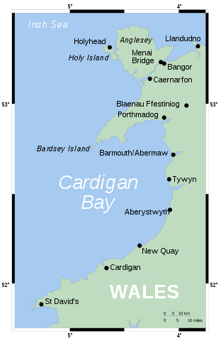
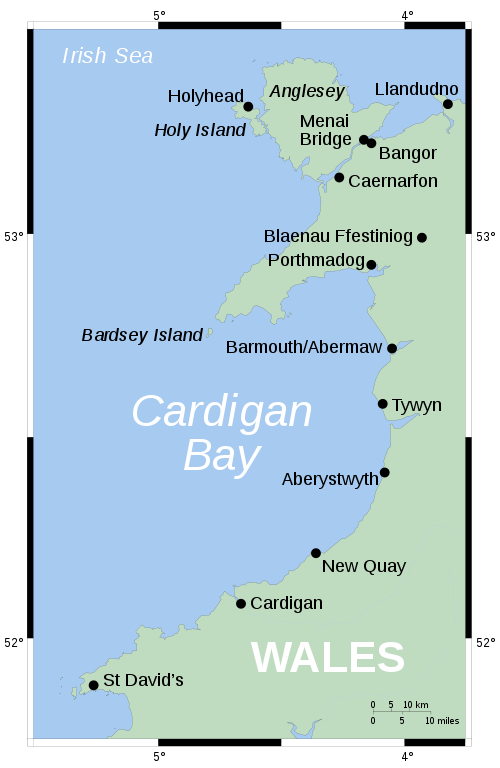
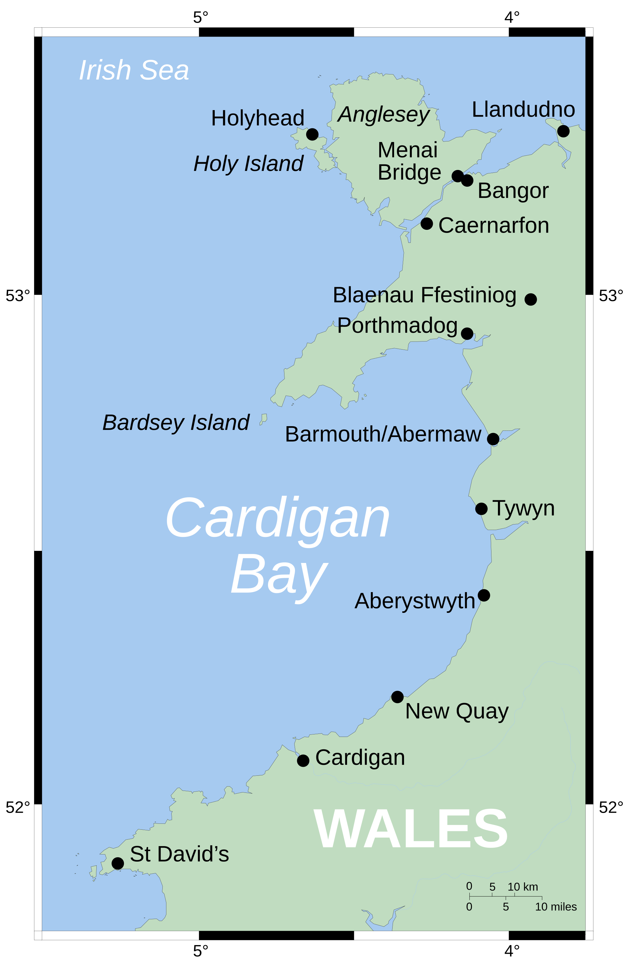
English: Map showing position of Cardigan Bay off Wales' west coast. Vector version of Image:CardiganBay.png on the English Wikipedia.
Mercator projection. Shore-line derived from GSHHS, rivers from the CIA World DataBank, both public-domain data sources. |
| Source | Travail personnel |
| Auteur | Wereon |
Conditions d’utilisation
| Moi, propriétaire des droits d’auteur sur cette œuvre, la place dans le domaine public. Ceci s'applique dans le monde entier. Dans certains pays, ceci peut ne pas être possible ; dans ce cas : J’accorde à toute personne le droit d’utiliser cette œuvre dans n’importe quel but, sans aucune condition, sauf celles requises par la loi. |
derivative works
Œuvres dérivées de ce fichier :
-
 Cymraeg
 -
 македонски


Historique du fichier
Cliquer sur une date et heure pour voir le fichier tel qu'il était à ce moment-là.
| Date et heure | Vignette | Dimensions | Utilisateur | Commentaire | |
|---|---|---|---|---|---|
| actuel | 9 août 2006 à 18:43 | | 2 030 × 3 120 (66 kio) | Wereon | oops, left the image in |
| 9 août 2006 à 18:41 |  | 2 030 × 3 120 (66 kio) | Wereon | MediaWiki's acting a bit funny... | |
| 9 août 2006 à 18:33 |  | 203 × 312 (62 kio) | Wereon | Map showing position of Cardigan Bay off Wales' west coast. Vector version of Image:CardiganBay.png on the English Wikipedia. Mercator projection. Shore-line derived from GSHHS, rivers from VMAP0, both public-domain data sources. |
Utilisation du fichier
La page suivante utilise ce fichier :
Usage global du fichier
Les autres wikis suivants utilisent ce fichier :
- Utilisation sur da.wikipedia.org
- Utilisation sur de.teknopedia.teknokrat.ac.id
- Utilisation sur en.wikipedia.org
- Utilisation sur eu.wikipedia.org
- Utilisation sur it.teknopedia.teknokrat.ac.id
- Utilisation sur la.wikipedia.org
- Utilisation sur lt.wikipedia.org
- Utilisation sur nl.teknopedia.teknokrat.ac.id
- Utilisation sur nn.wikipedia.org
- Utilisation sur pl.teknopedia.teknokrat.ac.id
- Utilisation sur pt.teknopedia.teknokrat.ac.id
- Utilisation sur ru.teknopedia.teknokrat.ac.id
- Utilisation sur sv.wikipedia.org
- Utilisation sur tt.wikipedia.org
- Utilisation sur zh.teknopedia.teknokrat.ac.id