


Taille de cet aperçu PNG pour ce fichier SVG : 361 × 600 pixels. Autres résolutions : 144 × 240 pixels | 289 × 480 pixels | 462 × 768 pixels | 616 × 1 024 pixels | 1 233 × 2 048 pixels | 602 × 1 000 pixels.
Fichier d’origine (Fichier SVG, nominalement de 602 × 1 000 pixels, taille : 249 kio)
Ce fichier et sa description proviennent de Wikimedia Commons.
Description
| Description |
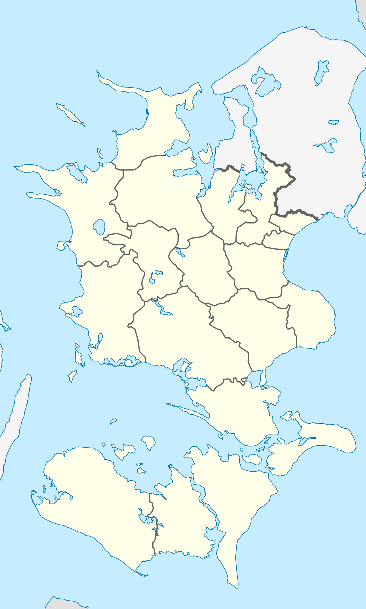
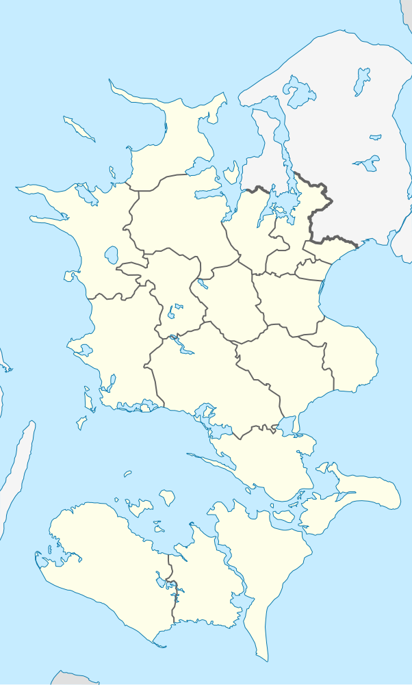
English: Location map of Region Zealand in Denmark
Equirectangular projection, N/S stretching 176 %. Geographic limits of the map:
Deutsch: Positionskarte von der Region Sjæland in Dänemark
Quadratische Plattkarte, N-S-Streckung 176 %. Geographische Begrenzung der Karte:
|
| Date | |
| Source | Travail personnel |
| Auteur | Erik Frohne |
| SVG information | Le code de ce fichier SVG n'est pas valide en raison d'une erreur. |
Conditions d’utilisation
Moi, en tant que détenteur des droits d’auteur sur cette œuvre, je la publie sous les licences suivantes :

|
Vous avez la permission de copier, distribuer et modifier ce document selon les termes de la GNU Free Documentation License version 1.2 ou toute version ultérieure publiée par la Free Software Foundation, sans sections inaltérables, sans texte de première page de couverture et sans texte de dernière page de couverture. Un exemplaire de la licence est inclus dans la section intitulée GNU Free Documentation License. |
Ce fichier est disponible selon les termes de la licence Creative Commons Attribution – Partage dans les Mêmes Conditions 3.0 (non transposée).
- Vous êtes libre :
- de partager – de copier, distribuer et transmettre cette œuvre
- d’adapter – de modifier cette œuvre
- Sous les conditions suivantes :
- paternité – Vous devez donner les informations appropriées concernant l'auteur, fournir un lien vers la licence et indiquer si des modifications ont été faites. Vous pouvez faire cela par tout moyen raisonnable, mais en aucune façon suggérant que l’auteur vous soutient ou approuve l’utilisation que vous en faites.
- partage à l’identique – Si vous modifiez, transformez, ou vous basez sur cette œuvre, vous devez distribuer votre contribution sous la même licence ou une licence compatible avec celle de l’original.
Vous pouvez choisir l’une de ces licences.
Historique du fichier
Cliquer sur une date et heure pour voir le fichier tel qu'il était à ce moment-là.
| Date et heure | Vignette | Dimensions | Utilisateur | Commentaire | |
|---|---|---|---|---|---|
| actuel | 13 janvier 2010 à 15:22 | | 602 × 1 000 (249 kio) | Erik Frohne | Reverted to version as of 16:15, 14 March 2009:Colors as agreed upon by german and french map makers. Use file Denmark Zealand location map (ca).svg instead if you need other colors |
| 29 décembre 2009 à 03:37 |  | 361 × 600 (635 kio) | Hubertus45 | Changing colour after consensus with other users. | |
| 15 décembre 2009 à 01:42 |  | 361 × 600 (635 kio) | Hubertus45 | Making the region more visible to the neighbour areas. | |
| 15 décembre 2009 à 01:35 |  | 361 × 600 (635 kio) | Hubertus45 | Making the region more visible to the neighbour areas. | |
| 14 mars 2009 à 18:15 |  | 602 × 1 000 (249 kio) | Erik Frohne | {{Information |Description={{en|1=Location map of Region Zealand in Denmark Equirectangular projection, N/S stretching 176 %. Geographic limits of the map: * N: 56.20° N * S: 54.50° N * W: 10.80° E * E: 12.60° E}} {{de|1=Positionskarte von der Regio |
Utilisation du fichier
Les 28 pages suivantes utilisent ce fichier :
- Char solaire de Trundholm
- Espergærde
- Faxe (Danemark)
- Fehmarn Belt
- Gedser
- Holbæk (commune)
- Kalundborg
- Køge
- Lejre
- Lolland (commune)
- Maribo
- Nakskov
- Nykøbing Falster
- Næstved
- Odsherred (commune)
- Phare de Stevns
- Péninsule de Stevns
- Ringsted
- Ringsted-Hallen
- Sejerø
- Slagelse
- Sorø
- Stevns
- Stevns Klint
- Vestenskov
- Vordingborg
- Église de Kappel
- Modèle:Géolocalisation/Sjælland
Usage global du fichier
Les autres wikis suivants utilisent ce fichier :
- Utilisation sur de.teknopedia.teknokrat.ac.id
- Askø
- Fejø
- Femø
- Agersø
- Omø
- Vejrø
- Sender Kalundborg
- Storstrømsbroen
- Farøbroerne
- Falster
- Bogø
- Sprogø
- Guldborgsund
- Orø
- Stevns
- Wikipedia:Kartenwerkstatt/Positionskarten/Europa
- Vorlage:Positionskarte Dänemark Sjælland
- Gedser Fyr
- Grønsund
- Stevns Klint
- Smålandsfarvandet
- Lilleø
- Skalø
- Rågø
- Rågø Kalv
- Vigsø
- Lindholm (Smålandsfarvandet)
- Suderø (Dänemark)
- Havneø
- Storstrømmen
- Ulvsund
- Langø
- Tærø
- Egholm (Agersø)
- Masnedø
- Farø
- Enø
- Glænø
- Nyord
- Gavnø
- Albuen
- Barneholm
- Enehøje
- Vejlø
- Slotø
- Hyllekrog
- Drummelholm
- Storeager
- Lilleager
- Lindholm (Stege Bugt)
Voir davantage sur l’utilisation globale de ce fichier.
