Taille de cet aperçu : 800 × 536 pixels. Autres résolutions : 320 × 215 pixels | 640 × 429 pixels | 1 024 × 687 pixels | 1 280 × 858 pixels | 2 904 × 1 947 pixels.
Fichier d’origine (2 904 × 1 947 pixels, taille du fichier : 2,64 Mio, type MIME : image/jpeg)
Historique du fichier
Cliquer sur une date et heure pour voir le fichier tel qu'il était à ce moment-là.
| Date et heure | Vignette | Dimensions | Utilisateur | Commentaire | |
|---|---|---|---|---|---|
| actuel | 12 décembre 2022 à 04:35 |  | 2 904 × 1 947 (2,64 Mio) | Hike395 | less jpeg compression, re-crop from original |
| 10 octobre 2011 à 03:32 |  | 2 916 × 1 948 (1,21 Mio) | Materialscientist | crop frame | |
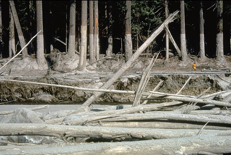
| 2 septembre 2010 à 16:02 |  | 3 072 × 2 048 (4,07 Mio) | Awickert | {{Information |Description={{en|1=(copied description from USGS site): Nearly 135 miles (220 kilometers) of river channels surrounding the volcano [Mt. St. Helens] were affected by the lahars of May 18, 1980. A mudline left behind on trees shows depths re |
Utilisation du fichier
La page suivante utilise ce fichier :
Usage global du fichier
Les autres wikis suivants utilisent ce fichier :
- Utilisation sur bg.wikipedia.org
- Utilisation sur bn.wikipedia.org
- Utilisation sur ceb.wikipedia.org
- Utilisation sur cs.wikipedia.org
- Utilisation sur de.teknopedia.teknokrat.ac.id
- Utilisation sur en.wikipedia.org
- Utilisation sur es.teknopedia.teknokrat.ac.id
- Utilisation sur he.wikipedia.org
- Utilisation sur teknopedia.teknokrat.ac.id
- Utilisation sur it.teknopedia.teknokrat.ac.id
- Utilisation sur nl.teknopedia.teknokrat.ac.id
- Utilisation sur oc.wikipedia.org
- Utilisation sur ro.wikipedia.org
- Utilisation sur sk.wikipedia.org
- Utilisation sur sv.wikipedia.org
- Utilisation sur tr.wikipedia.org
- Utilisation sur uk.wikipedia.org
- Utilisation sur vi.wikipedia.org
- Utilisation sur www.wikidata.org
- Utilisation sur zh.teknopedia.teknokrat.ac.id


