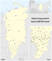
Taille de cet aperçu : 667 × 599 pixels. Autres résolutions : 267 × 240 pixels | 534 × 480 pixels | 855 × 768 pixels | 1 140 × 1 024 pixels | 2 006 × 1 802 pixels.
Fichier d’origine (2 006 × 1 802 pixels, taille du fichier : 634 kio, type MIME : image/png)
Historique du fichier
Cliquer sur une date et heure pour voir le fichier tel qu'il était à ce moment-là.
| Date et heure | Vignette | Dimensions | Utilisateur | Commentaire | |
|---|---|---|---|---|---|
| actuel | 23 décembre 2014 à 14:13 |  | 2 006 × 1 802 (634 kio) | Kaganer | "K" - Igarka, Added "O" - Norilsk |
| 3 avril 2010 à 07:37 |  | 2 006 × 1 802 (554 kio) | Chumwa | Farbanpassung in Orientierungskarte | |
| 3 avril 2010 à 07:30 |  | 2 006 × 1 802 (554 kio) | Chumwa | andere Schriftart | |
| 3 avril 2010 à 06:58 |  | 2 063 × 1 802 (563 kio) | Chumwa | == {{int:filedesc}} == {{Information |Description= {{de|Karte der Region Krasnojarsk}} {{en|Map of the Krasnoyarsk Krai}} 1 Aban • Абанский<br/> 2 Atschinsk • Ачинский<br/> 3 Balachta • Балахтинский<br/> 4 Berjosowka |
Utilisation du fichier
Les 3 pages suivantes utilisent ce fichier :
Usage global du fichier
Les autres wikis suivants utilisent ce fichier :
- Utilisation sur de.teknopedia.teknokrat.ac.id
- Utilisation sur mdf.wikipedia.org
- Utilisation sur pl.wikivoyage.org


