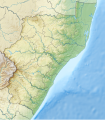
Taille de cet aperçu PNG pour ce fichier SVG : 526 × 600 pixels. Autres résolutions : 210 × 240 pixels | 421 × 480 pixels | 674 × 768 pixels | 898 × 1 024 pixels | 1 796 × 2 048 pixels | 1 000 × 1 140 pixels.
Fichier d’origine (Fichier SVG, nominalement de 1 000 × 1 140 pixels, taille : 2,28 Mio)
Historique du fichier
Cliquer sur une date et heure pour voir le fichier tel qu'il était à ce moment-là.
| Date et heure | Vignette | Dimensions | Utilisateur | Commentaire | |
|---|---|---|---|---|---|
| actuel | 5 janvier 2013 à 12:26 |  | 1 000 × 1 140 (2,28 Mio) | Htonl | {{Information |Description ={{en|1=Relief location map of en:KwaZulu-Natal Equirectangular projection, N/S stretching 114%. Geographic limits of the map: * N: 26.75° S * S: 31.25° S * W: 28.75° E * E: 33.25° E}} |Source =*[[:File:S... |
Utilisation du fichier
Les 13 pages suivantes utilisent ce fichier :
Usage global du fichier
Les autres wikis suivants utilisent ce fichier :
- Utilisation sur ar.teknopedia.teknokrat.ac.id
- Utilisation sur bg.wikipedia.org
- Utilisation sur ca.wikipedia.org
- Utilisation sur ceb.wikipedia.org
- Utilisation sur de.teknopedia.teknokrat.ac.id
- Cathedral Peak (Südafrika)
- St.-Lucia-See
- Tugela Falls
- Albert Falls Game Reserve
- Wikipedia:Kartenwerkstatt/Positionskarten/Afrika
- Cathkin Peak
- Albert-Falls-Stausee
- Pongolapoort-Stausee
- Howick Falls
- Vorlage:Positionskarte Südafrika KwaZulu-Natal
- Midmar-Stausee
- North Beach (Durban)
- Ithala Game Reserve
- Mkhuze Game Reserve
- Utilisation sur en.wikipedia.org
- Pietermaritzburg
- Hlathikhulu Forest Reserve
- Isandlwana
- Hluhluwe–Imfolozi Park
- Ithala Game Reserve
- UMkhuze Game Reserve
- Oribi Gorge
- Umlalazi Nature Reserve
- Lake Sibhayi
- Kosi Bay
- Tembe Elephant Park
- Ndumo Game Reserve
- Sani Pass
- Royal Natal National Park
- Mount Edgecombe Trophy
- Impati Mountain
- Spioenkop Dam Nature Reserve
- Bushman's Nek Pass
- De Beer's Pass, KwaZulu-Natal
- Endoumeni Pass
- Griffin's Hill
- Hela Hela Pass
- Ikhupe Pass
- Knight's Pass
- Albert Falls Game Reserve
- Albert Falls Dam
- Pongolapoort Dam
- Module:Location map/data/South Africa KwaZulu-Natal/doc
Voir davantage sur l’utilisation globale de ce fichier.


