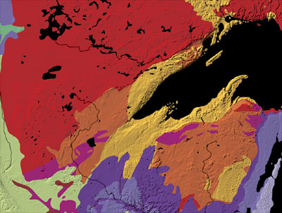
Superior_upland.jpg (400 × 302 pixels, taille du fichier : 40 kio, type MIME : image/jpeg)
Historique du fichier
Cliquer sur une date et heure pour voir le fichier tel qu'il était à ce moment-là.
| Date et heure | Vignette | Dimensions | Utilisateur | Commentaire | |
|---|---|---|---|---|---|
| actuel | 15 juin 2007 à 04:27 |  | 400 × 302 (40 kio) | Avenue | |
| 15 juin 2007 à 04:01 |  | 412 × 334 (46 kio) | Avenue | Geological map of the Superior Upland region in the United States. Lake waters and Canadian territory are both shown as black. Source: [http://tapestry.usgs.gov/features/01superior.html The Superior Upland], A Tapestry of Time and Terrain, U.S. Geologica |
Utilisation du fichier
La page suivante utilise ce fichier :
Usage global du fichier
Les autres wikis suivants utilisent ce fichier :
- Utilisation sur de.teknopedia.teknokrat.ac.id
- Utilisation sur en.wikipedia.org
- Utilisation sur it.teknopedia.teknokrat.ac.id
- Utilisation sur uk.wikipedia.org


