


Taille de cet aperçu PNG pour ce fichier SVG : 614 × 468 pixels. Autres résolutions : 315 × 240 pixels | 630 × 480 pixels | 1 008 × 768 pixels | 1 280 × 976 pixels | 2 560 × 1 951 pixels.
Fichier d’origine (Fichier SVG, nominalement de 614 × 468 pixels, taille : 100 kio)
Ce fichier et sa description proviennent de Wikimedia Commons.
Description
| Description |
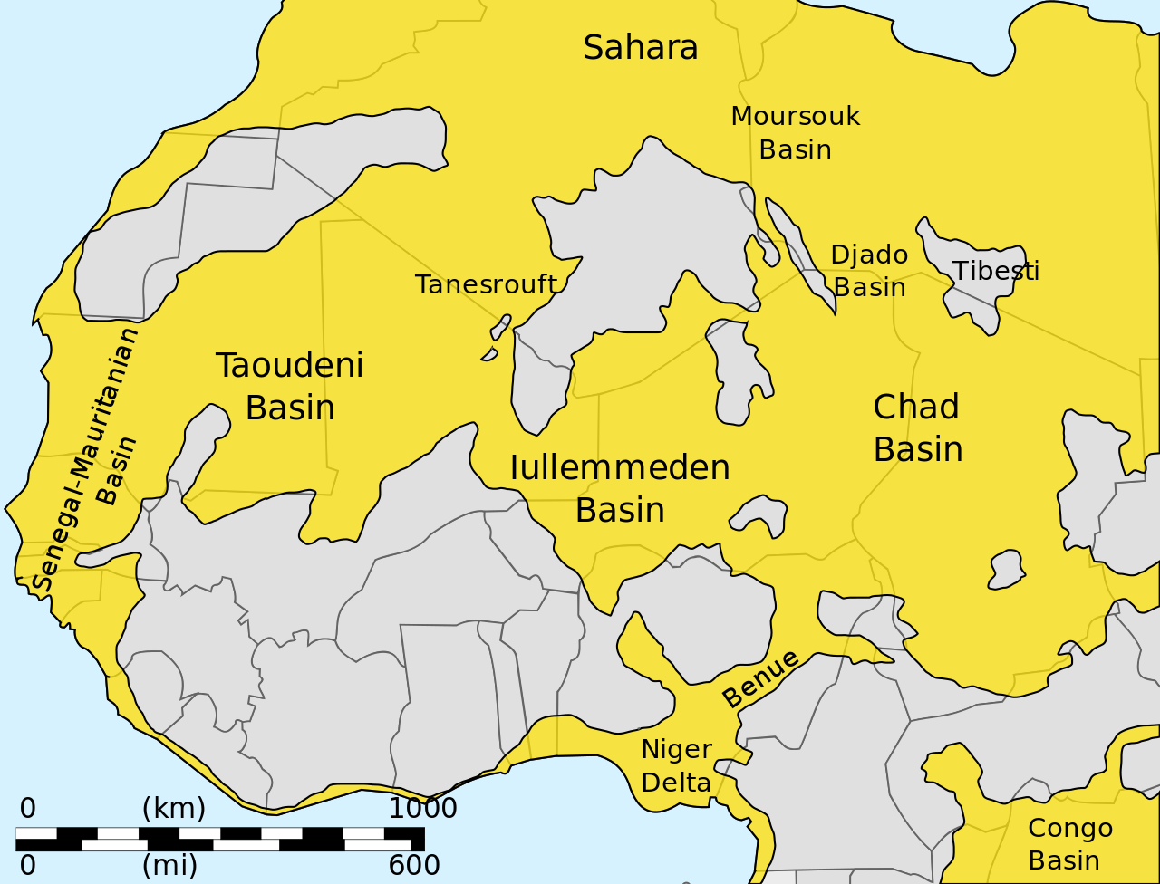
English: Sketch map showing major sedimentary basins of West Africa
العربية: خريطةٌ أوليّةٌ تُوضّح الأحواض الرسوبيّة الرئيسيّة لغرب إفريقيا |
| Date | |
| Source | Travail personnel |
| Auteur | Aymatth2 |
Conditions d’utilisation
| Moi, propriétaire des droits d’auteur sur cette œuvre, la place dans le domaine public. Ceci s'applique dans le monde entier. Dans certains pays, ceci peut ne pas être possible ; dans ce cas : J’accorde à toute personne le droit d’utiliser cette œuvre dans n’importe quel but, sans aucune condition, sauf celles requises par la loi. |
Historique du fichier
Cliquer sur une date et heure pour voir le fichier tel qu'il était à ce moment-là.
| Date et heure | Vignette | Dimensions | Utilisateur | Commentaire | |
|---|---|---|---|---|---|
| actuel | 26 juin 2011 à 09:21 | | 614 × 468 (100 kio) | Ciaurlec | Changed colours to uniform to other geological maps |
| 7 février 2011 à 16:26 |  | 614 × 468 (100 kio) | Ciaurlec | Separated object in layers; added basemap | |
| 18 décembre 2010 à 19:23 |  | 614 × 468 (40 kio) | Aymatth2 | {{Information |Description={{en|1=Sketch map showing major sedimentary basins of West Africa}} |Source={{own}} |Author=Aymatth2 |Date=2010-12-18 |Permission= |other_versions= }} Category:Geology of Africa |
Utilisation du fichier
La page suivante utilise ce fichier :
Usage global du fichier
Les autres wikis suivants utilisent ce fichier :
- Utilisation sur ar.teknopedia.teknokrat.ac.id
- Utilisation sur de.teknopedia.teknokrat.ac.id
- Utilisation sur el.wikipedia.org
- Utilisation sur en.wikipedia.org
- Utilisation sur es.teknopedia.teknokrat.ac.id
- Utilisation sur it.teknopedia.teknokrat.ac.id
- Utilisation sur nl.teknopedia.teknokrat.ac.id
- Utilisation sur pl.teknopedia.teknokrat.ac.id
- Utilisation sur ru.teknopedia.teknokrat.ac.id
- Utilisation sur uk.wikipedia.org
- Utilisation sur zh.teknopedia.teknokrat.ac.id