Khirbat al-Simia
| Nom officiel |
(ar) السيميا |
|---|---|
| Nom local |
(ar) خربة السيميا |
| Pays | |
|---|---|
| Territoire occupé | |
| Gouvernorat | |
| Coordonnées |
| Population |
1 705 hab. |
|---|
| Statut |
|---|
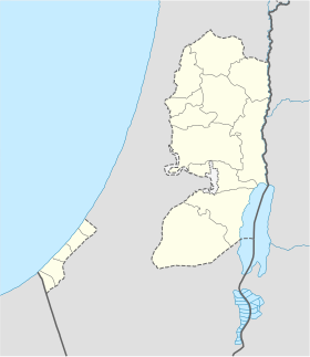
Géolocalisation sur la carte : Palestine
Khirbat al-Simia (en arabe : خربة السيميا), également appelé As-Simiya (السيميا, nom officiel), est un village palestinien situé dans le sud de la Cisjordanie. Rattaché au gouvernorat de Hébron, il se trouve à 4 kilomètres au nord-ouest de la ville d'As-Samu. Selon le Bureau central palestinien des statistiques, la population de Khirbat al-Simia s'élève à 1 705 habitants au milieu de l'année 2006.
Toponymie
Géographie
Histoire
Démographie
Politique et administration
Économie
Éducation
Transport
Notes et références
- (en) Cet article est partiellement ou en totalité issu de l’article de Wikipédia en anglais intitulé « Khirbat al-Simia » (voir la liste des auteurs).
Bibliographie
- (en) Claude Reignier Conder et H. H. Kitchener, The Survey of Western Palestine: Memoirs of the Topography, Orography, Hydrography, and Archaeology, vol. 3, Londres, Palestine Exploration Fund, (lire en ligne), pp. 313 et 378-9.
- Victor Guérin, Description Géographique, Historique et Archéologique de la Palestine, vol. 1: Judee, pt. 3, Paris, L'Imprimerie Nationale, (lire en ligne).
- (en) Wolf-Dieter Hütteroth et Kamal Abdulfattah, Historical Geography of Palestine, Transjordan and Southern Syria in the Late 16th Century, Erlanger Geographische Arbeiten, Sonderband 5., Erlangen (Allemagne), Société francique de géographie, , p. 123.
- (en) Census of Palestine 1931. Population of Villages, Towns and Administrative Areas, Jérusalem, Government of Palestine, (lire en ligne), p. 33 (Kh. Simia est décrit dans l'entrée « As-Samu »). [PDF]
- (en) E. H. Palmer, The Survey of Western Palestine: Arabic and English Name Lists Collected During the Survey by Lieutenants Conder and Kitchener, R. E. Transliterated and Explained by E.H. Palmer, Palestine Exploration Fund, (lire en ligne), p. 408.
Lien externe
- Carte de l'Hébron, Palestine Exploration Fund, 1880 (voir sur le site officiel des archives l'Autorité des antiquités d'Israël).


