Cet article recense les lieux patrimoniaux de Hamilton en Ontario inscrits au répertoire des lieux patrimoniaux du Canada, qu'ils soient de niveau provincial, fédéral ou municipal.
Liste
| [1] | Lieu patrimonial | Illustration | Adresse | Coordonnées | No | Constr. | Prot.[2] | Rec. | Notes |
|---|---|---|---|---|---|---|---|---|---|
| P | 59-63 King Street West, Dundas | 
|
59, King Street West | 43.2665 -79.9561 |
8267 | 1875 | Ontario Heritage Foundation Easement | 1979 | |
| F | Ancien édifice de la douane de Hamilton | 
|
51, Stuart Street | 43.2665 -79.8674 |
4000 | 1860 | LHN | 1990 | |
| F | Ancienne gare du Canadien National à Hamilton | 
|
360 James Street North | 43.2658 -79.865 |
7868 | 1931 | LHN | 2000 | |
| P | Auchmar | 
|
88, Fennell Avenue | 43.2391 -79.8821 |
8164 | 1855 | Ontario Heritage Foundation Easement | 2001 | |
| P | Bank of Montreal | 
|
1, Main Street West | 43.2552 -79.8701 |
8330 | 1928 | Ontario Heritage Foundation Easement | 1987 | |
| F | Bataille de Stoney Creek | 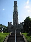
|
77 King Street West | 43.2175 -79.7661 |
16143 | LHN | 1960 | ||
| F | Bâtiment 2 | 
|
Catherine Street North | 43.2744 -79.8548 |
7523 | 1943 | Recognized Federal Heritage Building | 1992 | |
| P | Battlefield Monument – Stoney Creek Battlefield Park | 
|
77, King Street | 43.2181 -79.7664 |
8165 | 1913 | Ontario Heritage Foundation Easement | 1992 | |
| F | Burlington Heights | 
|
610 York Boulevard | 43.2719 -79.8859 |
1170 | 1813 | LHN | 1929 | |
| F | Château Dundurn | 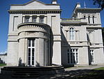
|
610 York Street | 43.2695 -79.8842 |
12341 | 1835 | LHN | 1984 | |
| P | Christ's Church Cathedral | 
|
252, James Street | 43.2632 -79.8663 |
8167 | 1873 | Ontario Heritage Foundation Easement | 1992 | |
| P | Church of the Ascension | 
|
64, Forest Avenue | 43.2495 -79.8698 |
8168 | 1851 | Ontario Heritage Foundation Easement | 1993 | |
| P | Dundas Central School | 
|
73, Melville Street | 43.2693 -79.9582 |
18023 | 1857 | Ontario Heritage Foundation Easement | 1990 | |
| F | Église presbytérienne St. Paul / Ancienne église St. Andrew | 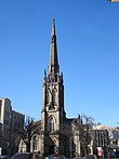
|
56 James Street South | 43.2548 -79.8701 |
12774 | 1857 | LHN | 1990 | |
| P | Gage House – Stoney Creek Battlefield Park | 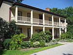
|
77, King Street | 43.2181 -79.7664 |
8166 | Ontario Heritage Foundation Easement | 1992 | ||
| F | Gare ferroviaire de la Canadien National | 
|
360 James Street North | 43.266 -79.865 |
6637 | 1931 | Heritage Railway Station | 1991 | |
| P | Hamilton CNR Station | 
|
360, James Street North | 43.2658 -79.8646 |
8341 | 1931 | Ontario Heritage Foundation Easement | 1999 | |
| P | Hamilton Custom House | 
|
51, Stuart Street | 43.2666 -79.8677 |
10496 | 1860 | Ontario Heritage Foundation Easement | 1982 | |
| F | Jardins botaniques royaux | 
|
680 Plains Road West | 43.2905 -79.8757 |
11665 | 1989 | LHN | 1993 | [3] |
| F | Maison Griffin | 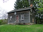
|
733 Mineral Springs Road | 43.2357 -80.0029 |
12521 | 1827 | LHN | 2008 | |
| F | Maison McQuesten / Whitehern | 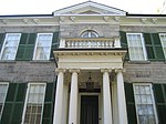
|
41 Jackson Street West | 43.2546 -79.872 |
12101 | 1848 | LHN | 1962 | |
| F | Maison-musée Erland-Lee | 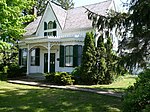
|
552 Ridge Road | 43.2066 -79.7208 |
9357 | 1808 | LHN | 2002 | |
| F | Manège militaire | 
|
200 James Street North | 43.2622 -79.8665 |
4303 | 1908 | Classified Federal Heritage Building | 1986 | |
| F | Manège militaire de John Weir Foote | 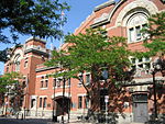
|
200 James Street North | 43.2622 -79.8665 |
7626 | 1888 | National Historic Site of Canada | 1989 | |
| P | McKinlay-McGinty House | 
|
232, Highway No. 8 | 43.1617 -80.1194 |
10514 | Ontario Heritage Foundation Easement | 1987 | ||
| F | NCSM Haida | 
|
650 Catharine Street North | 43.2754 -79.8561 |
7624 | 1942 | LHN | 1984 | |
| F | Sandyford Place | 
|
35-43 Duke Street | 43.2518 -79.8732 |
10706 | 1856 | LHN | 1975 | |
| P | Sandyford Place | 
|
35, Duke Street | 43.235 -79.8373 |
10566 | 1858 | Ontario Heritage Foundation Easement | 1979 | |
| F | Ancienne gare de la Toronto, Hamilton & Buffalo Railway | 
|
36 Hunter Street East | 43.253 -79.869 |
6531 | 1933 | GFP | 1991 | |
| F | Usine hydraulique de Hamilton | 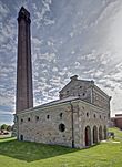
|
900 Woodward Avenue | 43.2565 -79.7719 |
4449 | 1859 | LHN | 1977 | |
| F | Victoria Hall | 
|
68 King Street East | 43.2568 -79.8695 |
2210 | 1888 | LHN | 1995 | |
| P | Waterdown Post Office | 
|
31, Main Street South | 43.3328 -79.8917 |
8210 | Ontario Heritage Foundation Easement | 1977 |
Notes et références
- ↑ Niveau de la désignation: F: Fédéral, P: Provincial, M: Municipal
- ↑ (fr) Répertoire canadien des lieux patrimoniaux : Manuel de normes de documentation, Annexe A : Vocabulaires contrôlés, p.59-78
(en) Canadian Register of Historic Places: Documentation Standards Handbook, Appendix A: Controlled Vocabulary, p.57-75 - ↑ Aussi dans la municipalité régionale de Halton
Annexes
Articles connexes
Liens externes
Pour l'ensemble des points mentionnés sur cette page : voir sur OpenStreetMap (aide), Bing Cartes (aide) ou télécharger au format KML (aide).
- « Lieux patrimoniaux du Canada »
- « Annuaire des désignations patrimoniales fédérales », sur Parcs Canada


